Credits & Data Sources
Play Deep Time Earth is built on the following open datasets and tools.
Data Sources
Cao et al. (2024), Earth's tectonic and plate boundary evolution over 1.8 billion years, model version 2.4
CC BY 4.0Continental crust fragments and plate boundaries at 540–1800 Ma. Not elevations, climate or actual palaeocoastlines.
Cao et al. (2024), Earth's tectonic and plate boundary evolution over 1.8 billion years, model version 2.4
Source ↗相关研究 ↗Modifications: Reconstructed using the model's palaeomagnetic frame and valid source ages. A fixed +60° eastward display rotation aids continuity without changing source data. Latitudes and poles are preserved; display longitudes differ from the model's. Plate boundaries use 5 Ma intervals; interpolation does not improve scientific accuracy. Continental configuration and shape differences remain at 540 Ma.
⚠ The dataset is CC BY 4.0, distinct from the paper's CC BY-NC-ND license. Paper figures and supplemental videos are not redistributed.
PaleoMIST 1.0
CC BY 4.0过去8万年的全球冰盖与古地形模型。原始数据间隔为2,500年,包含地壳变形和因位置而异的海平面变化。
Gowan, E.J. (2019). Global ice sheet reconstruction for the past 80000 years. PANGAEA, DOI 10.1594/PANGAEA.905800. Study: Gowan et al. (2021), A new global ice sheet reconstruction for the past 80,000 years, Nature Communications 12, 1199, DOI 10.1038/s41467-021-21469-w.
Source ↗相关研究 ↗Modifications: 将a1情景(MIS 3期间哈得孙湾持续被冰覆盖)的地形和重建冰盖边界加工用于显示。显示间隔2,500年的原始数据中最近的时点;现代对照线也来自同一模型。衍生数据:CC BY 4.0。 平滑边缘不等于更高的观测精度。显示时可能遗漏小岛和狭窄海峡,不能证明迁徙或可通行性。冰盖表示重建范围,并非海冰或确定的接地状态图。0 ka基准为1950年。不用于8万年前更早的时期,也不代表原作者的保证或认可。
模型基础资料
模型注明的基础资料。本服务使用PaleoMIST,不单独再分发下列原始数据、论文或图片。
- Schaffer, J. & Timmermann, R. (2016). Greenland and Antarctic ice sheet topography, cavity geometry, and global bathymetry (RTopo-2). · CC BY 3.0
- IceBridge MCoRDS L2 Ice Thickness, v1, DOI 10.5067/GDQ0CUCVTE2Q. Paden et al. (2010); cited as Leuschen et al., updated 2017, in the PaleoMIST README. Agassiz and Barnes Ice Cap corrections.
- Dowdeswell, J.A. et al. (2004). Form and flow of the Devon Island Ice Cap, Canadian Arctic. DOI 10.1029/2003JF000095. Devon Ice Cap correction.
- Hughes, A.L.C. et al. (2015/2016). DATED-1: Eurasian ice-sheet extent chronology. Dataset DOI 10.1594/PANGAEA.848117; study DOI 10.1111/bor.12142. · CC BY 3.0
- GLIMS Consortium et al. (2005). GLIMS Glacier Database, NSIDC-0272. DOI 10.7265/N5V98602; Raup et al. (2007), DOI 10.1016/j.gloplacha.2006.07.018.
- Fretwell, P. et al. (2013). Bedmap2: improved ice bed, surface and thickness datasets for Antarctica. DOI 10.5194/tc-7-375-2013. The linked BAS archive records the dataset under CC BY 4.0. · CC BY 4.0
- RAISED Consortium / Bentley, M.J. et al. (2014). A community-based geological reconstruction of Antarctic Ice Sheet deglaciation since the Last Glacial Maximum. DOI 10.1016/j.quascirev.2014.06.025. Cited study; separate GIS originals are not redistributed.
- Ehlers, J., Gibbard, P.L. & Hughes, P.D. (eds., 2011). Quaternary Glaciations—Extent and Chronology: A Closer Look. Patagonia reconstruction source cited by PaleoMIST.
NSIDC Sea Ice Index (G02135, Version 4)
NSIDC data use policy; attribution required北极海冰的现代夏季参考范围 · 1981–2010年9月
Fetterer, F., Knowles, K., Meier, W. N., Savoie, M., Windnagel, A. K. & Stafford, T. (2025). Sea Ice Index (G02135, Version 4). National Snow and Ice Data Center. https://doi.org/10.7265/a98x-0f50. Northern Hemisphere monthly September extent GeoTIFFs, 1981–2010; accessed 2026-09-28.
Source ↗DOI: 10.7265/a98x-0f50
Modifications: 从30个年份的9月海冰网格中提取至少一半年份有冰的区域,并缩小用于显示。排除陆地与海岸;未观测的极区保留原资料的有冰假定。这是固定的现代9月参考,并非当前状况、全年持续范围、厚度或古代海冰重建。
PaleoDEM
CC BY 4.0Paleodigital Elevation Models (0–540 Ma heightmaps)
Scotese, C.R. and Wright, N.M. (2018). PALEOMAP Paleodigital Elevation Models (PaleoDEMS) for the Phanerozoic.
Modifications: Terrain adapted for visualization with narrow-strait corrections. Modern coastline data is applied only at 0 Ma.
PaleoMAP PaleoCoastlines data v7.3
CC BY 4.081个全球海岸线重建时点(0–535 Ma)。依据化石记录调整PaleoDEM海岸线,以表示最大海侵范围。
Kocsis, A.T. and Scotese, C.R. (2023). PaleoMAP PaleoCoastlines data, v7.3. Zenodo. Study: Mapping paleocoastlines and continental flooding during the Phanerozoic, Earth-Science Reviews, DOI 10.1016/j.earscirev.2020.103463.
Source ↗相关研究 ↗Modifications: 将5–535 Ma的海岸线和内陆水域加工用于显示,并在原始年代之间插值。0 Ma采用Natural Earth现代海岸线及现有内陆水域;540 Ma采用基于地形的水域。衍生水域数据同样为CC BY 4.0。 水域:这些代表性重建图表示最大海侵范围,并非所选精确时刻的湖泊或海岸边界。原始年代之间的变化是视觉估算,不能据此确定水盆的隔离或重新连通时间。
Natural Earth
Public DomainOcean / marine polygons for shallow-sea correction at 0Ma (modern coastline)
Natural Earth — naturalearthdata.com
Modifications: Used to correct the display of modern coastlines and shallow seas.
CESM paleoclimate simulation
CC BY 4.00–540 Ma的表面温度、降水和风的模型数据
Li, X. et al. (2022). A high-resolution climate simulation dataset for the past 540 million years. Scientific Data, 9, 371.
DOI: 10.1038/s41597-022-01490-4
Modifications: CESM 表面温度年平均值(T):模型估计,并非对远古的直接观测。 为可视化进行加工,并在间隔10 Ma的原始年代之间插值。全球表面温度为面积加权年平均值。0 Ma代表工业化前;柯本为基于年平均值的近似分类。
PBDB
CC0 1.0Paleobiology Database (fossil occurrence records)
Peters, S.E. and McClennen, M. (2016). The Paleobiology Database application programming interface. Paleobiology, 42(1), 1-7.
Modifications: Up to 10,000 records sampled per 5 Ma window (0 Ma: 0–2.5 Ma), with supported ancient locations reconstructed. Sampling varies by age, region and taxon; counts are not abundance or biodiversity. Original references are available through PBDB.
GPlates / PyGPlates
GPL v2 (software; model data licensed separately)Tools for plate-tectonic and ancient-location reconstruction
Müller, R.D. et al. (2018). GPlates: Building a Virtual Earth Through Deep Time. G-cubed, 19.
DOI: 10.1029/2018GC007584
Modifications: Used to reconstruct ancient positions from the models.
SETON2012 rotation model
CC BY 4.00–200 Ma plate boundaries (separate model comparison)
Seton, M. et al. (2012). Global continental and ocean basin reconstructions since 200 Ma. Earth-Science Reviews, 113.
Modifications: 每隔5 Ma重建板块边界,并为显示进行简化。
PALEOMAP PaleoAtlas (rotation model)
CC BY 4.00–540 Ma coordinate reconstruction (Scotese 2016 reference frame; per-point validity checked)
Scotese, C.R. (2016). PALEOMAP PaleoAtlas for GPlates, v3. Zenodo.
Modifications: Ancient locations reconstructed for fossils, cities and geological events, within the model's supported locations and ages.
Müller 2022 rotation model
CC BY 4.0200–540 Ma plate boundary reconstruction
Müller, R.D. et al. (2022). A tectonic-rules-based mantle reference frame since 1 billion years ago – implications for supercontinent cycles and plate–mantle system evolution. Solid Earth, 13, 1127–1159. Model v1.2.4.
Modifications: 每隔5 Ma重建板块边界,并为显示进行简化。
PhyloPic
Per-image CC0 / CC BY化石详情和生物卡片中的类群剪影
PhyloPic — phylopic.org
Modifications: Resized for display. Each image includes its original attribution and artwork/license links.
ICS geological timescale 2026/06
CC BY 4.0Single source for geological boundaries and period names
International Commission on Stratigraphy, International Chronostratigraphic Chart, 2026/06.
Source ↗Modifications: Geological boundaries adapted for the service with translated names and service-selected display colors.
CenCO₂PIP v1.02
CC BY 4.01 Ma summaries of Cenozoic CO₂ proxy records
CenCO2PIP Consortium (2023), Science 382, eadi5177; vetted data v1.02 (2024).
Modifications: Eligible category 1/2 records; median of study medians. Ranges describe samples, not confidence intervals. Empty bins remain unavailable.
Miller 2020 sea level
CC BY 4.0Sea-level reconstruction, 0.98–64.82 Ma
Miller, K.G. et al. (2020). Smoothed Cenozoic sea-level relative to modern from deep-sea geochemical and continental margin records [dataset]. PANGAEA.
Modifications: Linear interpolation of supplied smoothed series; no extrapolation. 0 Ma is a present-day 0 m reference.
Macrostrat
CC BY 4.0Present-day map geology at 25 city centers
Macrostrat; Peters et al. (2018). Original map references retained and displayed for each city.
Source ↗Modifications: Selected geology information displayed for each city, retaining original unit names and ages. Not a paleomap or site survey.
板块边界来自独立对比模型,其参考框架不同于PALEOMAP地形和坐标,可能与海岸线不重合。
由风和海温推导的示意图,并非海洋环流模拟;粒子速度不代表实际流速。
Wind: CESM annual mean U/V, 1000 hPa. Atmospheric rim glow is decorative.
人类起源、迁徙与相遇——研究来源
各事件的年代、地点、证据及不确定性均根据所链接的原始研究独立编写。本站不再分发论文正文、图片或基因序列。各论文及其数据保留各自权利。
文献审阅日期: 2026-10-12
- Multiple Deeply Divergent Denisovan Ancestries in PapuansJacobs et al. · 2019-04-11 · DOI: 10.1016/j.cell.2019.02.035
- Independent age estimates resolve the controversy of ancient human footprints at White SandsPigati et al. · 2023-10-05 · DOI: 10.1126/science.adh5007
- The age of the opening of the Ice-Free Corridor and implications for the peopling of the AmericasClark et al. · 2022-03-21 · DOI: 10.1073/pnas.2118558119
- New fossils from Jebel Irhoud, Morocco and the pan-African origin of Homo sapiensHublin et al. · 2017-06-07 · DOI: 10.1038/nature22336
- A weakly structured stem for human origins in AfricaRagsdale et al. · 2023-05-17 · DOI: 10.1038/s41586-023-06055-y
- Pleistocene chronology and history of hominins and fauna at Denisova CaveJacobs et al. · 2025-05-21 · DOI: 10.1038/s41467-025-60140-6
- Denisovan mitochondrial DNA from dental calculus of the >146,000-year-old Harbin craniumFu et al. · 2025-06-18 · DOI: 10.1016/j.cell.2025.05.040
- The proteome of the late Middle Pleistocene Harbin individualFu et al. · 2025-06-18 · DOI: 10.1126/science.adu9677
- Ancient proteins identify various Denisovan remains from Southwest ChinaRao et al. · 2026-09-09 · DOI: 10.1038/s41586-026-10976-9
- Denisovans from southwestern China and their subsistence strategiesRuan et al. · 2026-09-09 · DOI: 10.1038/s41586-026-10997-4
- The genome of the offspring of a Neanderthal mother and a Denisovan fatherSlon et al. · 2018-08-22 · DOI: 10.1038/s41586-018-0455-x
- Major expansion in the human niche preceded out of Africa dispersalHallett et al. · 2025-06-18 · DOI: 10.1038/s41586-025-09154-0
- Neanderthal ancestry through time: Insights from genomes of ancient and present-day humansIasi et al. · 2024-12-12 · DOI: 10.1126/science.adq3010
- Earliest modern human genomes constrain timing of Neanderthal admixtureSümer et al. · 2024-12-12 · DOI: 10.1038/s41586-024-08420-x
- Genomic evidence supports the “long chronology” for the peopling of SahulGandini et al. · 2025-11-28 · DOI: 10.1126/sciadv.ady9493
- Middle and Late Pleistocene Denisovan subsistence at Baishiya Karst CaveXia et al. · 2024-07-03 · DOI: 10.1038/s41586-024-07612-9
- Genetic diversity of late Neanderthals in northwestern EuropeBossoms Mesa et al. · 2026-06-24 · DOI: 10.1038/s41586-026-10625-1
- The evolutionary history and unique genetic diversity of Indigenous AmericansAraújo Castro e Silva et al. · 2026-04-22 · DOI: 10.1038/s41586-026-10406-w
- A male Denisovan mandible from Pleistocene TaiwanTsutaya et al. · 2025-04-10 · DOI: 10.1126/science.ads3888
- A new global ice sheet reconstruction for the past 80,000 yearsGowan et al. · 2021-02-23 · DOI: 10.1038/s41467-021-21469-w
- Climatic windows for human migration out of Africa in the past 300,000 yearsBeyer et al. · 2021-08-24 · DOI: 10.1038/s41467-021-24779-1
- Human occupation of northern India spans the Toba super-eruption ~74,000 years agoClarkson et al. · 2020-02-25 · DOI: 10.1038/s41467-020-14668-4
- The Persian plateau served as hub for Homo sapiens after the main out of Africa dispersalVallini et al. · 2024-03-25 · DOI: 10.1038/s41467-024-46161-7
- Homo sapiens reached the higher latitudes of Europe by 45,000 years agoMylopotamitaki et al. · 2024-01-31 · DOI: 10.1038/s41586-023-06923-7
- 40,000-Year-Old Individual from Asia Provides Insight into Early Population Structure in EurasiaYang et al. · 2017-10-12 · DOI: 10.1016/j.cub.2017.09.030
- The population history of northeastern Siberia since the PleistoceneSikora et al. · 2019-06-05 · DOI: 10.1038/s41586-019-1279-z
- Terminal Pleistocene Alaskan genome reveals first founding population of Native AmericansMoreno-Mayar et al. · 2018-01-03 · DOI: 10.1038/nature25173
- Early human dispersals within the AmericasMoreno-Mayar et al. · 2018-11-08 · DOI: 10.1126/science.aav2621
- Nuclear DNA sequences from the Middle Pleistocene Sima de los Huesos homininsMeyer et al. · 2016-03-14 · DOI: 10.1038/nature17405
- Neanderthals in central Asia and SiberiaKrause et al. · 2007-09-30 · DOI: 10.1038/nature06193
- Genetic insights into the social organization of NeanderthalsSkov et al. · 2022-10-19 · DOI: 10.1038/s41586-022-05283-y
博物馆标本
博物馆公开的独立标本照片,不表示与地图上的PBDB记录属于同一标本。学名与年代保留博物馆目录原文。
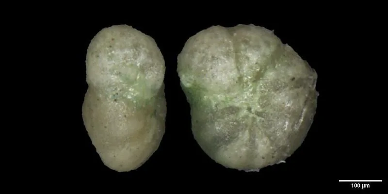
Anomalina beccariiformis (White, 1928)
CC46806 · Mesozoic / Cretaceous / Late
Smithsonian Institution, National Museum of Natural History
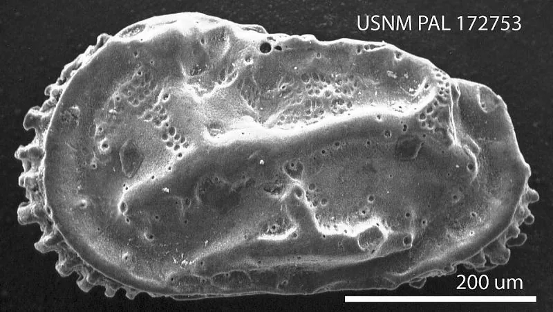
Neocaudites triplistriatus (Edwards, 1944)
PAL172753 · Cenozoic / Neogene / Miocene
Smithsonian Institution, National Museum of Natural History
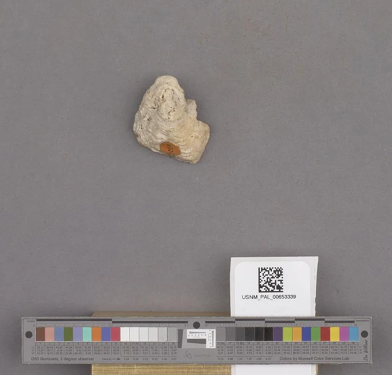
Bivalvia
PAL653339 · Cenozoic / Quaternary / Pleistocene
Smithsonian Institution, National Museum of Natural History
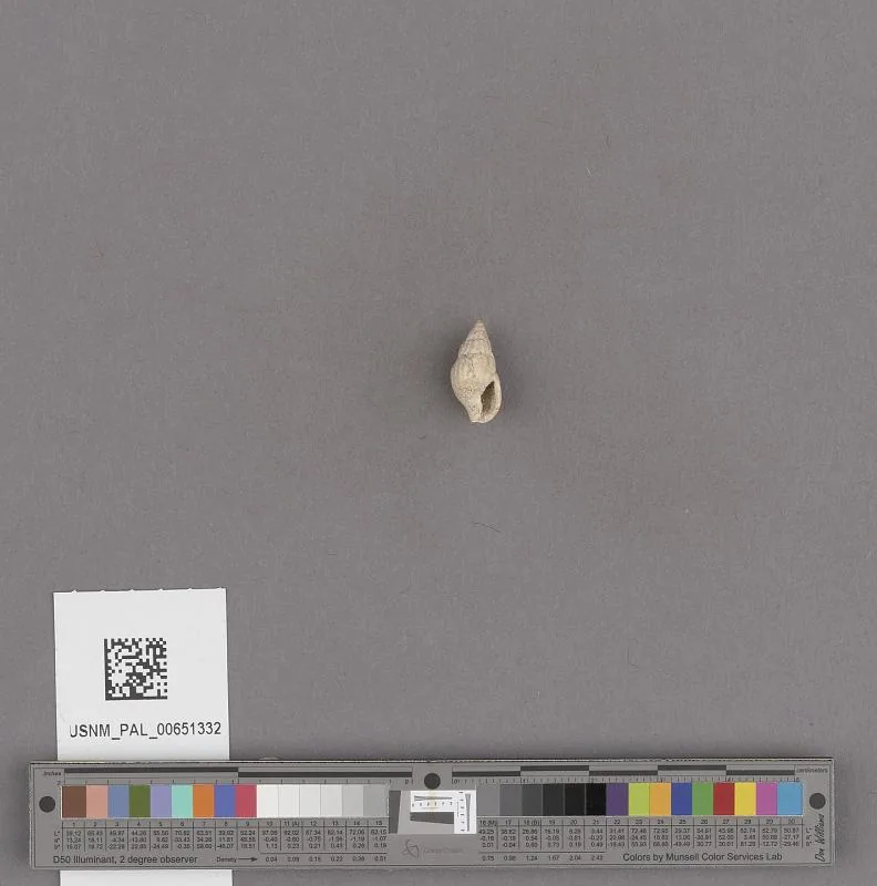
Amphissa reticulata Dall
PAL651332 · Cenozoic
Smithsonian Institution, National Museum of Natural History
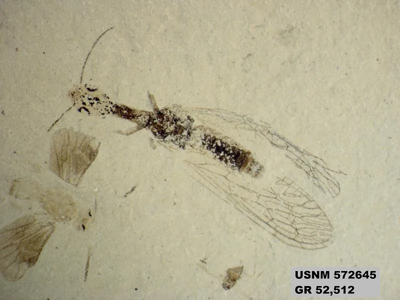
Genus sp
PAL572645b · Cenozoic / Paleogene / Eocene
Smithsonian Institution, National Museum of Natural History
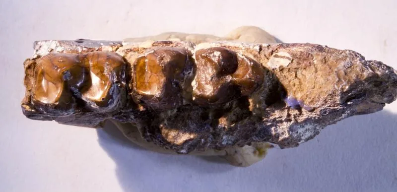
Hyracotherium tapirinum (Cope)
V1076 · Cenozoic / Paleogene / Eocene / Wasatchian
Smithsonian Institution, National Museum of Natural History
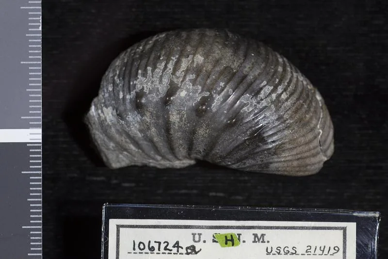
Desmoscaphites erdmanni Cobban
PAL106724 · 博物馆未提供年代
Smithsonian Institution, National Museum of Natural History
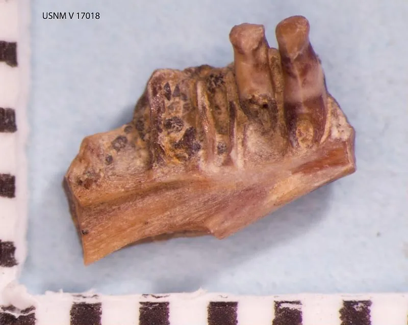
Habrosaurus dilatus Gilmore, 1928
V17018 · Mesozoic / Cretaceous / Late / Maastrichtian
Smithsonian Institution, National Museum of Natural History
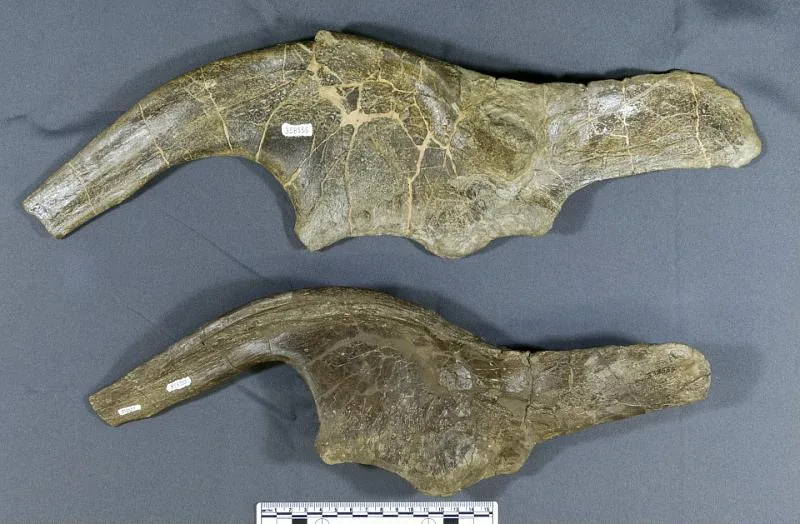
Kritosaurus sp
PAL358555 · Mesozoic / Cretaceous / Late / Campanian
Smithsonian Institution, National Museum of Natural History
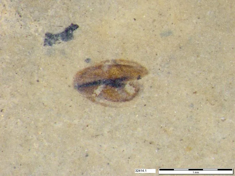
Tracheophyta
PAL722538 · Cenozoic / Paleogene / Eocene / Middle
Smithsonian Institution, National Museum of Natural History
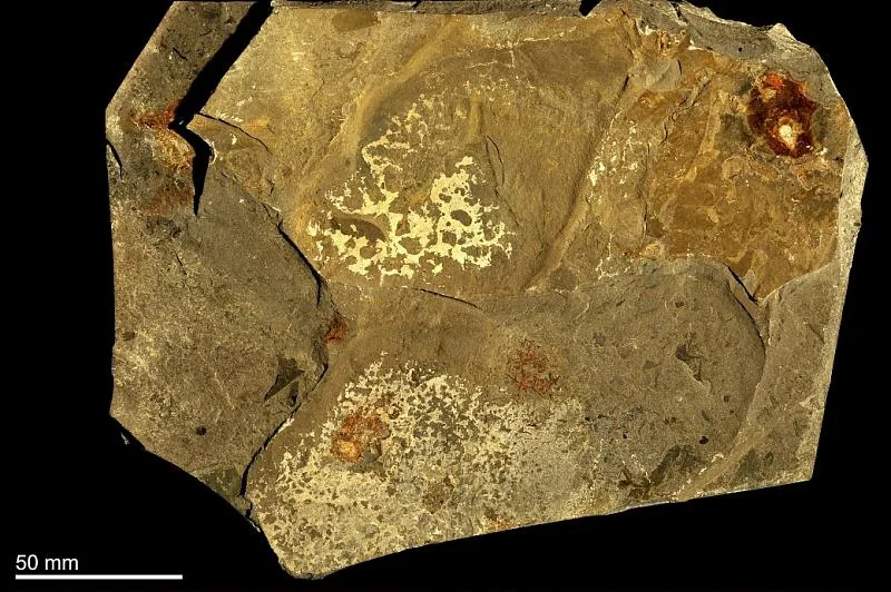
Anomalocaris canadensis Whiteaves, 1892
PAL213890 · Paleozoic / Cambrian / Middle
Smithsonian Institution, National Museum of Natural History
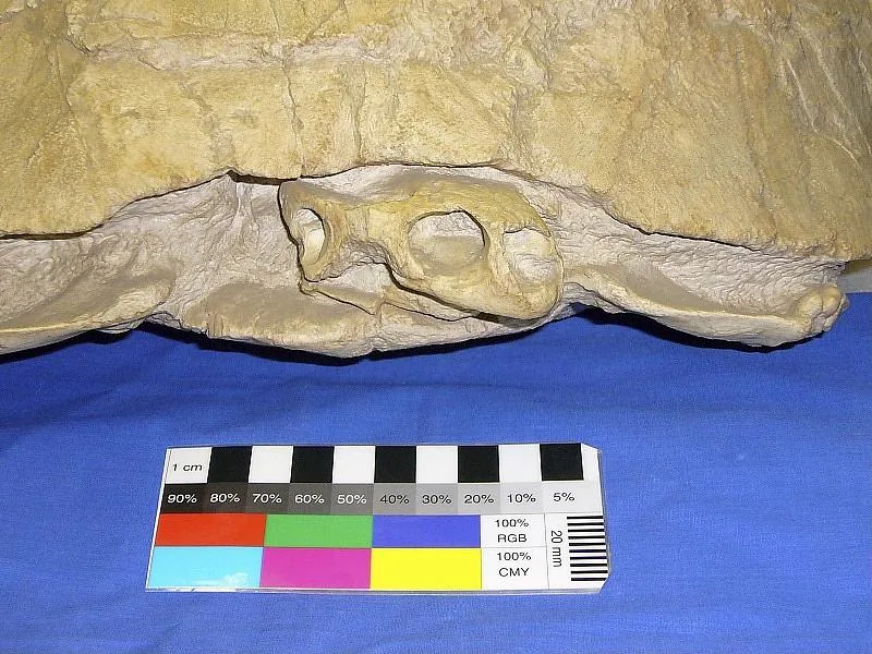
Stylemys nebrascensis Leidy, 1851
PAL358863 · Cenozoic / Paleogene / Oligocene
Smithsonian Institution, National Museum of Natural History
12 / 40张照片
Other Assets
Geist Font
Google Fonts (Vercel)
OFL 1.1
Noto Sans CJK Bold / Deep Time Share
Noto Project — modified font used in share images
OFL 1.1
O₂ literature ranges
Mills et al. (2023), Evolution of Atmospheric O₂ Through the Phanerozoic, Revisited, DOI 10.1146/annurev-earth-032320-095425
Original literature summary
생물군/계통수
Compiled from textbooks and literature
Editorially curated